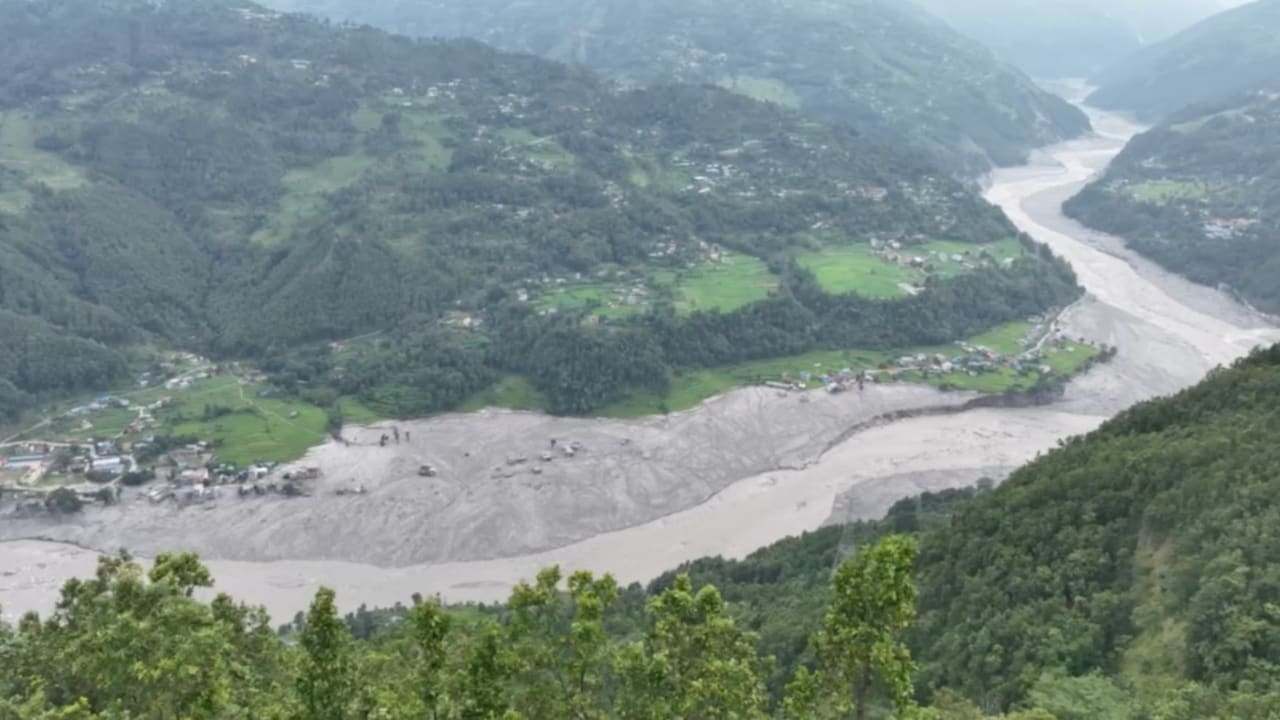
Rapid glacial destabilization along the Nepal-China border produces cascading hydrological failures that conventional disaster response models cannot adequately contain. When high-altitude ice and rock detach in regions like Langtang National Park, the resulting mass transforms within minutes into a hyper-concentrated debris flow racing down river corridors such as the Lende Khola, Bhote Koshi, and Trishuli. Examining this cross-border disaster requires moving past descriptive casualty tallies to evaluate the structural vulnerabilities embedded in high-altitude engineering, early warning transmission limits, and multi-agency jurisdictional friction.
The Hydraulic Mechanics of High-Altitude Flash Floods
Disasters originating from glacial and periglacial zones operate on compression principles entirely distinct from standard monsoonal river swelling. The physical mechanism driving events like the Rasuwagadhi border disaster is not merely excess water volume, but kinetic energy multiplication through sediment-load density.
When millions of cubic meters of ice and rock collapse, the solid-to-liquid ratio in the resulting wave creates a debris flow with a specific gravity far exceeding normal river water. This hyper-dense slurry scours riverbeds, undercuts valley walls, and incorporates structural infrastructure into its mass.
- Initiation Vector: Thermal stress, localized permafrost thaw, or seismic shifts trigger the primary structural failure of a hanging glacier or moraine wall.
- Amplification Phase: The descent funnels through steep Himalayan gorges, entraining accumulated scree, soil, and forest debris, which swells the total mass exponentially over a distance of kilometers.
- Attenuation and Deposition: Upon reaching wider valley floors or human settlements, the velocity drops sharply, causing instantaneous aggradation—dumping meters of boulders, mud, and ice across roads, tunnels, and residential zones.
The speed of this transition invalidates traditional hydrological lead times. Even when automated sensors register an upstream anomaly, the compression of time and space in deep gorges leaves a narrow operational window for downstream evacuation.
Infrastructure Vulnerability and the Hydropower Bottleneck
Economic development patterns in the Himalayas concentrate high-capital infrastructure precisely within high-risk dynamic zones. Hydropower projects require narrow, high-gradient river valleys to maximize head, placing generation plants, worker housing, and diversion tunnels directly in the path of debris torrents.
The structural interaction between flash floods and subterranean infrastructure creates compounding survival hazards. Operations at facilities like the Upper Trishuli-1 and Rasuwagadhi projects demonstrate how construction design interacts with catastrophic sediment loads:
- Tunnel Entrapment Dynamics: When surface portals are choked by incoming boulder and mud debris, long diversion and access tunnels transform from transit routes into potential air-pockets or burial chambers. Workers seeking shelter inside face asphyxiation risks if ventilation shafts fail, even if the primary structural bore withstands the hydrostatic pressure.
- Asset Clustering Failure: Ancillary infrastructure—access bridges, transmission pylons, and batching plants—are typically clustered on the immediate river terraces, which double as the active floodplain during extreme debris flows. The destruction of a single upstream bridge isolates downstream recovery zones, converting a localized impact into a regional logistics failure.
Capital allocation in Himalayan engineering has historically prioritized energy output optimization over geotechnical risk mitigation. Protective engineering standards must shift from designing for peak historical water flows to mitigating dynamic, high-density sediment impacts.
Information Asymmetry in Cross-Border Disaster Management
The data discrepancies that characterize transboundary disaster reporting stem from structural gaps in international telemetry sharing and administrative jurisdiction. When a mass flow originates in Tibet and impacts central Nepal, the timeline of information exchange governs the survival curve.
[Glacial Collapse]
       │
       ▼ (Minutes)
[High-Velocity Debris Flow]
       │
       ▼ (Telemetry Lag)
[Cross-Border Reporting Disconnect]
       │
       ▼ (Operational Friction)
[Divergent Casualty and Missing Datasets]
This structural disconnect manifests in three distinct data friction points:
- Jurisdictional Boundary Silos: Real-time sensor data managed by upstream authorities does not consistently integrate with downstream emergency dispatch systems, delaying initial public warnings.
- Disparate Accounting Metrics: Official tallies diverge because agencies utilize different inclusion criteria for missing persons. While police forces track active family missing-person filings, tourism boards rely on unverified trekking agency manifests, and corporate entities track transient construction workforces.
- Transient Population Tracking: High concentrations of migrant laborers, cross-border traders, and un-registered religious pilgrims create a baseline demographic that is fundamentally invisible to static census models, rendering pre-disaster population denominators impossible to calculate accurately.
Resolving these information gaps requires standardized cross-border telemetry protocols and unified digital registries for temporary workforces operating within high-risk river corridors.
Deploy heavy-lift rotary-wing assets to establish persistent supply lines over compromised road networks while simultaneously deploying micro-boring technology to clear tunnel air-locks at impacted hydroelectric sites.