The barometer on the porch wall dropped three millibars before noon.
It was a quiet signal, almost imperceptible against the heavy, wet heat hanging over the Gulf Coast. Most people watch the sky for a storm. They look for the towering anvil clouds, the dark green bruising on the horizon, or the first sharp crack of lightning. But anyone who has lived within smelling distance of salt water for more than a decade knows the true mark of a tropical system is not in the sky at all. Also making headlines in related news: Why Summons and Condemnations expose the Deep Failure of Maritime Policy.
It is in the tide.
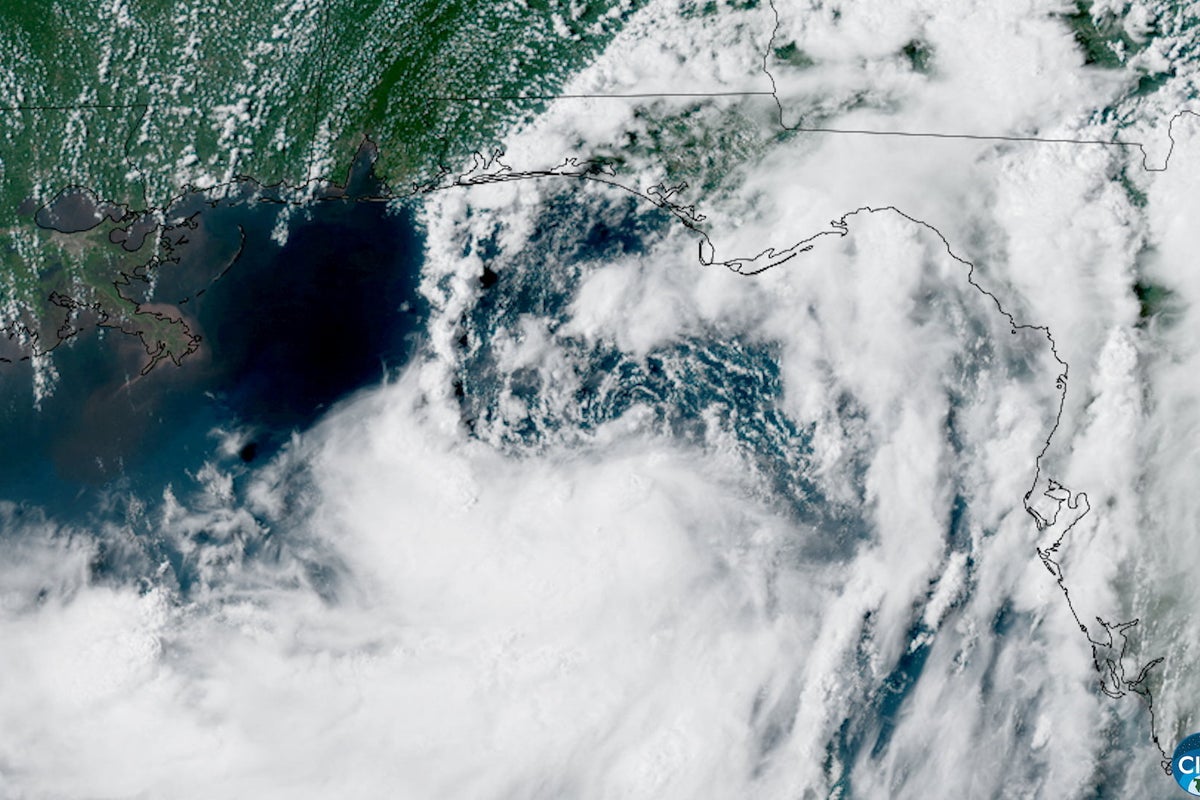
Consider a hypothetical resident named Marcus, standing on the edge of a timber dock in southern Louisiana as Tropical Storm Bertha approaches. The wind at his back is barely a whisper—fifteen miles an hour, nothing more than a stiff breeze that might blow a ball cap into the marsh. On the radar screen glowing inside his living room, Bertha looks like a disorganized swirl of grey and yellow pixels, barely scraping together enough convection to earn a name. The cable news commentators call it a "weak tropical system." Additional insights on this are explored by TIME.
They are looking at the wind. Marcus is looking at the water.
Long before a tropical storm makes landfall, long before the first gust rips a aluminum shingle from a roof, the ocean begins to pile up. A storm is not merely a cloud of wind and rain; it is a massive, spinning plow dragging the surface of the sea ahead of it. As Bertha churns across the shallow shelf of the Gulf of Mexico, her low atmospheric pressure lifts the sea level beneath her like a giant suction cup, while her counterclockwise winds pack hundreds of thousands of tons of water into a suffocating mound.
That mound has nowhere to go except inland.
The Physics of a Silent Threat
We tend to measure storms by the Saffir-Simpson scale. Category 1. Category 3. Category 5. It is a neat, tidy system that ranks hurricanes entirely by maximum sustained wind speeds.
It is also dangerously misleading.
Wind breaks branches. Wind knocks out power lines. But water kills. Historically, nearly ninety percent of all direct fatalities in tropical cyclones are caused by water, with storm surge accounting for almost half of those deaths.
Imagine pushing a full bathtub from one side of a room to the other. If you move slowly, the water sloshes gently. But if you shove the tub with steady, persistent force, a wall of water surges over the rim long before you reach the opposite wall. The Gulf Shelf is that shallow bathtub. When a broad storm like Bertha—even a relatively weak one in terms of wind—marches toward the low-lying coast, it acts as a persistent shove.
The geometry of the shoreline dictates the violence of the surge. Where the ocean floor slopes gently, as it does along much of the Gulf Coast, the energy of the water cannot disperse downward into deep abyssal trenches. Instead, that kinetic energy is forced upward and forward. Channels, bays, and estuaries act as funnels, cramming the rising water into tighter spaces and forcing it up into living rooms, high-energy corridors, and coastal bypasses.
A three-foot surge sounds manageable on paper. It sounds like something you can walk through in rubber boots.
It isn't.
Water weighs roughly sixty-two pounds per cubic foot. A wave just two feet deep moving at six miles per hour carries the kinetic force of a wall of concrete collapsing inward. It strips tires off rims. It lifts two-ton pickup trucks like plastic toys. It undermines the foundations of homes, washing out the packed soil beneath slab foundations until the structure simply buckles under its own weight.
When the Evacuation Order Comes
By mid-afternoon, the sky above the coast turns a strange, bruised shade of lavender. The air feels sticky, thick enough to chew.
Inside the local emergency management center, the monitors display color-coded inundation maps. The red zone—indicating ground that will be completely submerged—stretches miles inland, crawling over marshlands, highway overpasses, and suburban cul-de-sacs. The satellite telemetry shows Bertha slowing down.
Slowness is a curse.
When a storm moves quickly, its surge hits like a sledgehammer and retreats. When a storm crawls, it pushes water into the coast through multiple high-tide cycles. It locks the estuaries. The rain falling inland cannot drain into the ocean because the ocean is rising up to meet it. The rivers back up. The drainage ditches fill from both ends. The land becomes a trap.
Emergency directors do not issue mandatory evacuations lightly. The economic cost of emptying a city is staggering. Traffic grinds to a halt on interstate corridors. Fuel supplies vanish from gas stations within hours. Families debate what to pack in the tight confines of a trunk: birth certificates, family photo albums, a dog crate, two days of clean clothes.
The decision to stay or go often comes down to a false sense of security. A homeowner looks out the window, sees three-inch branches swaying gently in a light breeze, and thinks the meteorologists are exaggerating. They compare Bertha to the monster storms of memory—the category four and five beasts that flattened whole counties. They assume that because the wind is not screaming, the threat is not real.
That error in judgment is where lives are lost.
The Inundation
Night falls early under the thick deck of storm clouds. The streetlights flicker, turn amber, and die as feeder bands strike the offshore power grid.
Then comes the water.
It does not arrive as a towering tidal wave from a Hollywood disaster film. It arrives as an insidious, relentless tide that refuses to stop rising. It creeps up the driveway first, dark and oily, carrying bits of marsh grass and plastic trash. It fills the gutters. It surges over the curb.
Within thirty minutes, the street has disappeared. Within an hour, the water is pressing against the baseboards of front porches.
In the dark, you hear the surge before you see it. It is a heavy, rhythmic rushing sound, punctuated by the metallic clatter of trash cans rolling down the submerged street and the distant, haunting wail of car alarms short-circuiting underwater. The sea tastes of salt and diesel fuel, mud and decay.
Inside a home built three feet above ground level, the floorboards begin to groan. The pressure of the sea beneath the crawlspace pushes upward. Carpets soak through from below. Power outlets sizzle and snap as the water reaches the lower drywall.
This is the hidden crisis of a storm surge. Once you are trapped in a home surrounded by six feet of rushing water, there is no rescue coming until the storm passes. Boats cannot navigate residential streets in gale-force winds without risking flipped hulls or shredded propellers on submerged fences and power lines. First responders are ordered to shelter in place.
You are entirely alone with the ocean.
Grounded in Reality
The science of tropical meteorology has made immense strides in predicting where a storm's center will track. Supercomputers run ensemble models every six hours, churning through billions of data points gathered by weather satellites, ocean buoys, and reconnaissance aircraft flying directly into the eye wall.
Yet, predicting exact surge heights remains one of the hardest challenges in modern earth science. A shift of five miles in the storm’s track can mean the difference between a dry neighborhood and three feet of saltwater in your kitchen. A minor change in the angle of approach can double the volume of water pushed into a bayou.
That uncertainty is why forecasters emphasize the worst-case scenario maps. They are not trying to cause panic. They are trying to communicate the physical reality of fluid dynamics to a population accustomed to measuring risk only by wind speed.
When official warnings cite "life-threatening storm surge," it is an absolute statement of physical law. The ocean is reclaiming land that used to belong to it, propelled by planetary forces that care nothing for property lines, brick facades, or human hesitation.
The tide finally begins to turn in the gray hours before dawn.
The center of Tropical Storm Bertha shifts inland, her winds weakening over the pine forests and swamp basins. On the coast, the water recedes as reluctantly as it arrived, leaving behind a thick layer of gray silt, shattered marsh reeds, and the heavy smell of low tide.
Street signs lean at broken angles. Front lawns are littered with the detritus of disrupted lives: couch cushions, soaked insulation, children's toys coated in mud.
The wind is gone. The sky clears to a pale, washed-out blue. And on the porch step, right where the water marked its highest advance, a single hermit crab crawls across the wet concrete, miles away from the beach where it started.