Urban-Wildland Interface Vulnerability Matrix
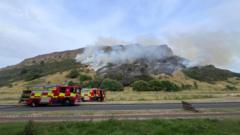
Ignition events on Arthur’s Seat reflect structural vulnerabilities inherent to the Urban-Wildland Interface (WUI). The 198-hectare Holyrood Park site features sharp topographical gradients, dense fuel loads, and high human foot traffic immediately adjacent to high-density residential zones like Pollock Halls and Holyrood.
Wildfires in semi-arid microclimates or during extended dry spells follow a deterministic propagation framework driven by three fundamental variables: fuel moisture content, wind velocity vectors, and slope elevation angles.
       [ Ignition Event ]
               │
               ▼
   ┌───────────────────────┐
   │ Fuel Moisture Deficit │ ── (Gorse / Dry Biomass)
   └───────────┬───────────┘
               │
               ▼
   ┌───────────────────────┐
   │ Slope Accelerators    │ ── (Thermal Chimney Effect)
   └───────────┬───────────┘
               │
               ▼
┌───────────────────────────────┐
│ Dynamic Fire Vector Spread    │ ── (Radiant Heat & Spotting)
└───────────────────────────────┘
The primary vegetation type involved in open fires across Arthur’s Seat consists of Ulex europaeus (common gorse). Gorse exhibits high volatile oil concentration—roughly 4% by dry weight—and maintains a high ratio of dead woody material trapped beneath a living green canopy. When relative humidity drops and ambient temperatures rise, fuel moisture content within the gorse canopy falls below critical thresholds (under 15%), transforming the slope’s surface layer into a highly volatile fuel bed.
Slope Acceleration and Convective Vectors
Topography acts as a force multiplier for surface flame spread. On steep inclines, flames tilt closer to unburned fuels further up the slope, increasing radiant heat transfer.
$$R = R_0 \cdot e^{a\theta}$$
Where:
- $R$ represents the rate of fire spread on a slope.
- $R_0$ is the base rate of spread on flat terrain.
- $\theta$ is the slope angle in degrees.
- $a$ is an empirical terrain constant (~0.069).
At slope angles exceeding 30 degrees, which characterize significant sections of Arthur’s Seat, the rate of spread doubles relative to flat ground. The terrain creates a thermal chimney effect: convective heat preheats upper-lying vegetation, driving rapid uphill ignition along natural gullies and rocky outcroppings.
Tactical Response Limitations and Dispatch Bottlenecks
Emergency interventions on isolated urban peaks encounter strict mechanical and spatial constraints. Deploying standard urban fire appliances to open land incidents introduces immediate logistical bottlenecks.
[ Operations Control (101/999 Alert) ]
                  │
                  ▼
   [ First-Pumper Unit Mobilization ]
                  │
                  ▼
   [ Perimetric Containment & Lay-down ] ── (Road Closures: Queen's Drive)
                  │
                  ▼
   [ Manual Hose Layout / Foot Patrol ] ── (Elevation Loss & Water Weight)
- Hydraulic Line Extension Deficits: Standard urban pumping appliances carry limited hose runs and fixed onboard water capacities (typically 1,800 to 2,000 liters). Extending handlines uphill requires static high-pressure relay pumps, leading to pressure losses of roughly 0.1 bar per meter of vertical elevation gain, alongside friction loss over extended hose lengths.
- Access Road Geometry: Road closures along major thoroughfares such as Queen's Drive isolate vehicular access to the base perimeter. Transporting heavy equipment from perimeter staging areas up steep, unpaved inclines relies heavily on manual transport or off-road light utility vehicles.
- Resource Split Constraints: Multi-incident occurrences across regional park networks stretch emergency response capacity. Simultaneous deployments reduce available reserve appliances, forcing operational control to rely on targeted containment tactics over direct saturation spraying.
The Three Pillars of Fire Containment in Complex Urban Topography
Containing open-land vegetation fires requires transitioning from offensive direct suppression to perimeter-focused defensive containment strategies.
Firebed Isolation
Crews establish manual control lines using beaters, brush hooks, and tactical backburns where safe, stripping fuel ahead of the advancing fire front. Suppressing the flanks restricts sideways expansion into contiguous brush zones.
Direct Thermal Suppression
Targeted application of water combined with wetting agents lowers fuel temperatures below thermal ignition points. Because high-volume water application uphill remains mechanically restricted, crews prioritize direct suppression on low-angle terrain near critical infrastructure.
Boundary Containment and Infrastructure Shielding
Perimeter road closures serve as natural firebreaks. Positioning pumpers at lower elevation perimeters prevents sparks from jumping into urban structures, residential blocks, and tourist facilities.
Long-Term Fuel Management Strategic Requirements
Relying purely on reactive emergency dispatch creates systemic operational drag and recurring fiscal expenditure. Mitigating fire frequency on high-visibility urban peaks requires preemptive vegetation management strategies:
- Controlled Mosaic Burning and Mechanical Flailing: Implementing planned mechanical removal of high-volatility gorse patches creates permanent fuel breaks along primary footpaths, preventing low-intensity ignitions from escalating into full-scale slope fires.
- Static Off-Grid Water Storage Installation: Installing localized, subterranean raw-water holding tanks along strategic high-elevation access points cuts setup time for relay pumping operations during critical initial attack phases.
- Thermal Imaging Drone Integration: Deploying unmanned aerial vehicles equipped with radiometric thermal sensors allows operators to identify subterranean hot spots within deep peat or root networks, preventing reignition after surface flames are extinguished.
Executing a structured vegetation control plan paired with localized water infrastructure offers the only viable path to reducing fire severity and protecting municipal emergency resources over extended dry operational cycles.