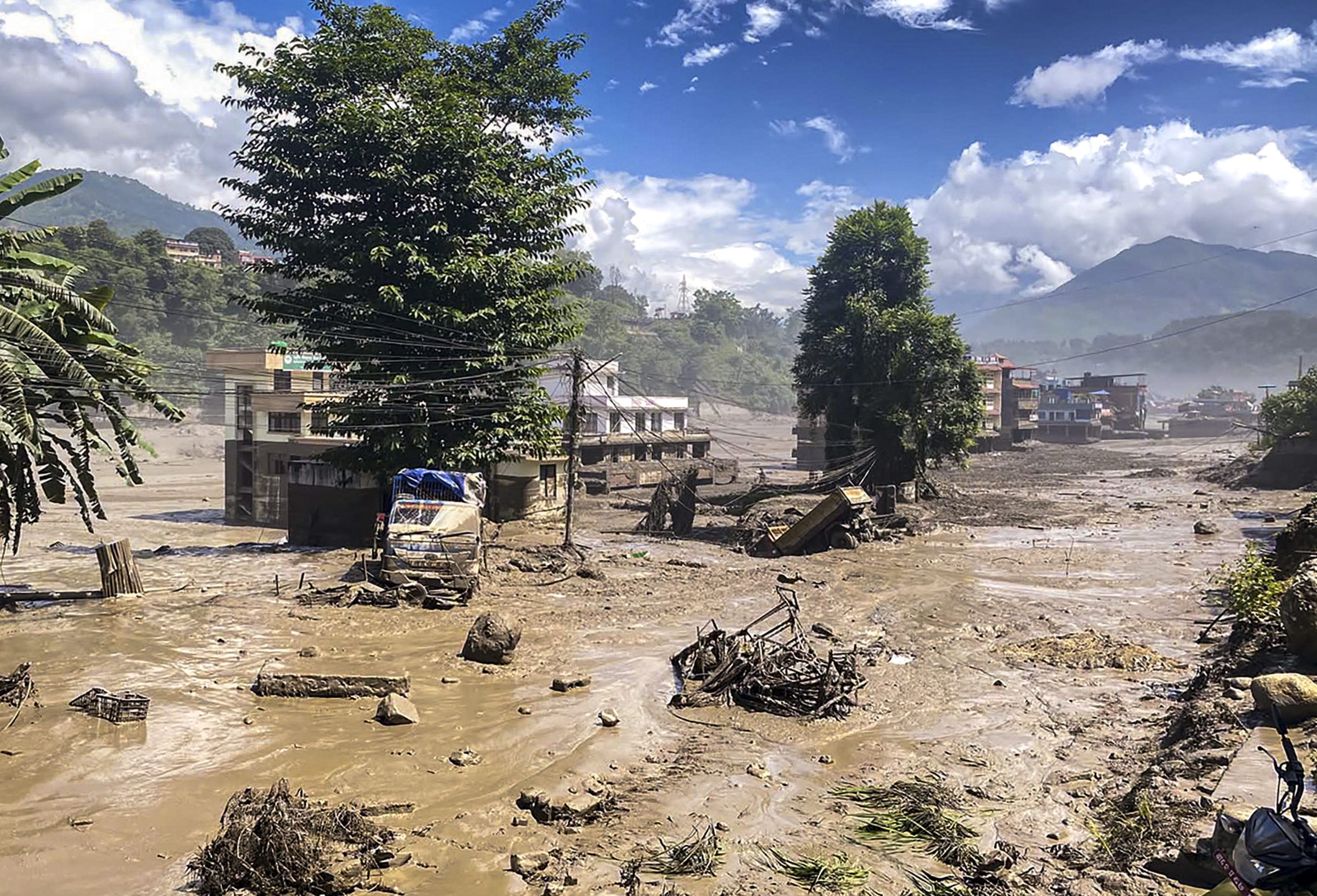
When the Bhote Koshi River violently breached its banks on a quiet Wednesday morning, it did more than sweep away concrete structures and remote settlements in central Nepal. It exposed the terrifying speed at which Himalayan geography is turning against the communities living in its shadows. The disaster, triggered by an ice-rock avalanche that choked the Lhende Khola tributary before unleashing a catastrophic wall of water downstream, left scores dead and hundreds unaccounted for.
Standard news coverage focuses heavily on the immediate casualty figures and the dramatic, muddy footage broadcast across social networks. Yet, looking past the surface imagery reveals an escalating structural crisis. This catastrophe is part of a relentless, accelerating pattern across the Hindu Kush Himalaya where warming temperatures, fragile geology, and rapid infrastructure expansion collide with lethal consequences.
The Mechanics of an Invisible Fuse
Understanding why these valleys are transforming into high-risk zones requires looking far above the human settlements, high up into the precipitous crags of the Tibetan borderlands. Glaciers across the region are retreating and destabilizing at rates that have doubled since the turn of the century. As ice melts and permafrost thaws, massive quantities of loose rock and debris lose their structural integrity.
When an ice-rock avalanche violently crashes into a narrow mountain gorge, it acts as a temporary earthen dam. Water pools rapidly behind this unstable barrier, forming an improvised lake that exerts immense hydrostatic pressure. Eventually, the barrier fails. The resulting outburst sends a concentrated, hyper-concentrated torrent of mud, boulders, and water tearing through narrow mountain passes with little to no advanced warning.
Communities situated along lower river terraces have mere minutes to react. Sirens and manual observation posts cannot outpace a wall of water dropping thousands of feet down steep valley gradients. The topography itself ensures that early warning systems remain fundamentally constrained by physics.
The Hydropower Vulnerability Paradox
Nepal’s push for green energy independence has created a secondary crisis along these volatile river systems. To harness the immense energy of rushing Himalayan rivers, developers have concentrated multibillion-dollar run-of-the-river hydroelectric projects directly inside deep, narrow gorges.
These projects are brilliant engineering feats under normal operational parameters. During a glacial outburst or severe ice avalanche, however, they become catastrophic bottlenecks. When the Bhote Koshi surge hit last Wednesday, it severely damaged multiple critical generation and transmission facilities, knocking out hundreds of megawatts of capacity in a single morning.
Energy planners face an agonizing dilemma. The country desperately needs domestic power generation to fuel its economy and transition away from imported fossil fuels. Building those plants anywhere other than high-energy river corridors is geographically impossible. Yet placing billion-dollar infrastructural assets in active avalanche and glacial lake outburst flood paths without radical engineering redesigns guarantees recurring economic and structural devastation.
Standard civil engineering metrics used globally are failing in the Himalayas. Concrete penstocks and diversion dams designed to withstand standard monsoon discharge volumes are utterly overwhelmed when pulverized by millions of tons of mobile debris traveling at highway speeds.
The Cross-Border Information Void
Mitigating these disasters requires unprecedented international cooperation, particularly between nations sharing transboundary river basins. The origin points for many of Nepal's worst flash floods lie upstream in the Tibet Autonomous Region of China.
Real-time hydrological data sharing across geopolitical boundaries remains notoriously sluggish. By the time seismic sensors or upstream monitoring stations register an anomalous drop or surge in water levels, downstream authorities in districts like Rasuwa have precious little window to push evacuation alerts to villagers and tourists.
Hundreds of foreign nationals and domestic travelers caught unaware in these remote valleys highlight the persistent gaps in tourism safety protocols. Trekking routes hugging volatile river corridors remain open deep into seasons marked by high geological volatility. Tour operators and local authorities often weigh immediate economic survival against abstract environmental risks, keeping trails populated until a catastrophe forces a temporary reckoning.
Rethinking Survival in a Warming Range
Solving the systemic vulnerability of central Nepal’s river corridors requires abandoning the illusion that these events are purely unpredictable "acts of God." Climate researchers have mapped high-risk watersheds across the Hindu Kush Himalaya with terrifying precision.
Adapting to this new reality demands moving away from reactive rescue operations toward aggressive spatial planning. That means enforcing strict no-build zones along low-lying river terraces, regardless of local economic pressure. It means embedding satellite-linked ground sensors directly into high-altitude glacial lakes and tributary bottlenecks to buy crucial seconds of automated warning time.
Until regional infrastructure and human settlement patterns are fundamentally decoupled from the most hazardous riverbeds, every monsoon season and sudden thaw will carry the threat of another avoidable tragedy downstream.