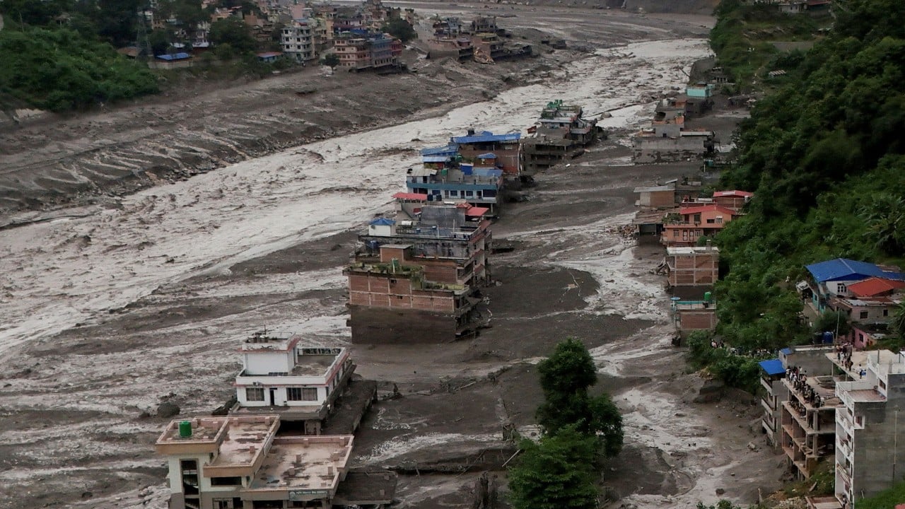
The catastrophic flash flood that tore through Nepal's Himalayan river valleys was not born from ordinary monsoon rains, nor was it a standard glacial lake outburst. At precisely 8:37 a.m. local time, an enormous section of a high-altitude glacier near the border of Nepal and Tibet sheared free, plunging 1,200 meters from a ridge on Langtang Lirung. The impact registered on global seismographs as a magnitude 5.2 event, initially misdiagnosed by distant algorithms as a tectonic earthquake. It was not an earthquake. It was an ice-and-rock avalanche of staggering proportions that liquefied into a high-speed debris flow, wiping out remote settlements and leaving hundreds dead or missing along the Bhotekoshi and Trishuli river corridors.
This disaster exposes a terrifying structural vulnerability across the Hindu Kush Himalaya region. Mountain communities and downstream infrastructure are built around an assumption of geological stability that no longer exists. Also making waves in related news: The Eight Armed Guard Protecting Our Shores From a Crab Takeover.
The Physics of High-Altitude Catastrophe
Understanding why this wall of mud, ice, and water materialized requires looking at the mechanics of thawing mountain environments. Glaciers do not merely sit on rock faces; they act as structural props, anchoring steep slopes through sheer weight and freezing adhesion.
Permafrost is the invisible cement holding the high peaks together. When atmospheric temperatures rise persistently above historical averages, that subterranean cement thaws. The ice crystals binding soil, fractured boulders, and hanging glaciers lose their structural integrity. Water from early surface melting percolates deep into newly formed fissures. As temperatures fluctuate, that water freezes and expands, acting as a mechanical wedge that prizes the rock apart. More details on this are covered by NBC News.
When a mass like the one on Langtang Lirung lets go, the transformation is instantaneous. Millions of cubic meters of solid ice and rock smash into the valley floor. The kinetic energy is staggering. Upon impact, a massive fraction of the ice instantly liquefies from the release of mechanical energy, mixing with local riverbeds, accumulated sediment, and loose soil.
It turns into a slurry that behaves less like water and more like liquid concrete. This debris flow moves at terrifying speeds, defying standard flood routing models. By the time the surge hit populated sectors like Syabrubesi, water levels in local tributaries had risen by up to nine meters in less than thirty minutes.
Why Traditional Warning Systems Failed
Early detection remains the single greatest barrier to saving lives in high-mountain Asia. Seismic networks picked up the event the second it occurred, but seismometers record vibrations; they do not automatically translate those squiggles on a screen into evacuation orders.
Disaster management authorities in Kathmandu received notification from cross-border channels roughly twenty minutes after the initial collapse. In a flash flood moving down narrow, steep valleys at highway speeds, twenty minutes is an eternity too late. SMS-based public alerts reached some schools and administrative centers just as the slurry breached local riverbanks.
The geography of the Himalayas works against early warning infrastructure.
- Remote monitoring stations are scarce at elevations above 5,000 meters.
- Rapidly forming ice-rock avalanches do not leave behind the slow-filling reservoirs associated with traditional glacial lakes.
- Cross-border communication lag times between regional neighbors delay critical upstream data sharing.
Communities downstream are left completely blind. Traditional flood early warning systems were engineered for monsoon river swelling, where water levels rise over hours or days. They are entirely useless against an instantaneous sub-aerial landslide that turns a dry gorge into a churning torrent of debris in seconds.
The Blind Spots in Regional Risk Assessments
Governments and international agencies have spent decades mapping and monitoring potentially dangerous glacial lakes. These are the obvious ticking clocks—pools of meltwater held back by unstable moraine dams that threaten to burst.
Ice-rock avalanches from hanging glaciers represent a completely different hazard category. They require no pre-existing lake to trigger a catastrophe. They can originate from dry, sheer rock faces that appeared stable decades ago. Consequently, risk maps maintained by organizations like the International Centre for Integrated Mountain Development (ICIMOD) focus heavily on standing water bodies while dry, high-altitude slopes remain largely unmonitored.
Satellites can capture structural changes after the fact, but continuous, real-time radar interferometry required to spot a cliff face slowly pulling away from a mountain is prohibitively expensive and technically complex in high-altitude environments. The financial resources of regional governments are funneled into post-disaster rescue and recovery rather than preventative, high-altitude remote sensing.
The Hard Limits of Adaptation
It is tempting to look at events like this and demand structural defenses. Engineers frequently propose check dams, diversion channels, and reinforced embankments along vulnerable river corridors.
In practice, these engineering interventions face severe limitations when confronted with a full-scale glacial collapse. A debris flow carrying hundreds of thousands of tons of car-sized boulders and shattered ice will easily smash through standard concrete engineering works. Building structures capable of withstanding the kinetic energy of a multi-million-cubic-meter mountain collapse is economically unfeasible and practically impossible across hundreds of kilometers of rugged terrain.
Hard engineering treats symptoms while ignoring the root driver. As atmospheric warming continues to erode permafrost across the Hindu Kush Himalaya, the structural stability of the entire range is shifting. Glaciers will continue to retreat, leaving over-steepened rock walls exposed to extreme weather cycles.
The disaster in Nepal is a stark preview of an unfolding reality. Mountain ranges that took millions of years to form are destabilizing in decades, and the communities living in their shadows are running out of time.