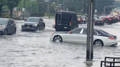
Urban flash flooding in the New York-New Jersey metropolitan area is not an isolated meteorological anomaly but a predictable systemic failure of aging civil infrastructure challenged by changing precipitation profiles. When torrential rain intersects dense municipal environments, the resulting crisis is governed by a rigid mathematical relationship between precipitation intensity, surface permeability, and subterranean drainage throughput capacity. To evaluate the true risk profile of the Tri-State region, analysts must abandon sensationalist weather reporting and instead evaluate the concrete failure modes of the region's built environment.
The Tri-State Hydrological Equation
To quantify the scale of a flash flood event, civil engineers rely on the Rational Method to calculate peak storm water runoff. The formula dictates that the peak discharge rate is a direct product of the runoff coefficient, the rainfall intensity, and the drainage area.
$$Q = CiA$$
In this equation:
- Q represents the peak runoff rate measured in cubic feet per second.
- C represents the dimensionless runoff coefficient, reflecting the percentage of rainfall that does not infiltrate the ground.
- i represents the rainfall intensity, measured in inches per hour.
- A represents the drainage area in acres.
In a natural environment, the runoff coefficient (C) typically ranges from 0.10 to 0.30, as vegetation and soil absorb the vast majority of precipitation. In the hyper-urbanized corridors of New York City and northeastern New Jersey, the proliferation of asphalt, concrete, and roofing structures pushes the runoff coefficient to between 0.70 and 0.95. This means that up to 95% of all falling water immediately converts into surface runoff, bypassing natural earth absorption entirely.
When an intense storm cell drops multiple inches of water within a concentrated window, the variable i spikes exponentially. Because C is already maximized due to decades of impervious surface construction, the resulting peak discharge (Q) rapidly exceeds the structural limits of the receiving municipal systems.
The Architecture of Structural Bottlenecks
The primary vulnerability of the New York-New Jersey metropolitan infrastructure lies in its subterranean design limitations. The region relies heavily on two distinct types of wastewater networks, each presenting specific failure points during high-intensity precipitation events.
Combined Sewer Systems (CSS)
A significant portion of older urban centers, including large swathes of Manhattan, Brooklyn, and older New Jersey cities like Jersey City and Newark, utilize Combined Sewer Systems. These networks collect domestic sewage, industrial wastewater, and surface runoff within a single pipeline network for transport to a centralized water pollution control plant.
During dry weather or low-intensity rain, the CSS functions within its operational envelope. However, the system features a rigid capacity ceiling. When surface runoff exceeds the volumetric limit of the interceptor pipes or the treatment capacity of the downstream facility, regulators activate diversion structures. This results in Combined Sewer Overflows (CSOs)—direct discharges of untreated industrial waste, human sewage, and toxic street runoff into local waterways. The system sacrifices environmental safety to prevent the physical rupture of underground assets or the backflow of wastewater into residential basements, though the latter frequently occurs when hydraulic pressure peaks.
Municipal Separate Storm Sewer Systems (MS4)
In newer developments and suburban zones of New Jersey and outer New York boroughs, stormwater is segregated from municipal sewage via Municipal Separate Storm Sewer Systems. While this prevents the raw sewage contamination inherent to CSS failures, MS4 networks remain bound by static pipe diameters and gravity-fed flow dynamics.
The fundamental engineering flaw of regional MS4 infrastructure is its vintage. Much of the network was calculated using mid-20th-century historical weather data, which assumed a "5-year or 10-year storm event" standard. Under these legacy guidelines, pipes were sized to handle maximum rainfall intensities of roughly 1.5 inches per hour. Modern cloudburst events regularly deliver 2 to 3 inches of rain per hour. When the volume of surface water arriving at a catch basin exceeds the maximum intake velocity of the grate or the internal volumetric capacity of the connecting lateral pipe, a hydraulic bottleneck occurs. Water pools on the surface, transforming streets into active drainage channels.
+--------------------------------------------------------+
|               High-Intensity Rain Event                |
|           (Exceeding 2.0 Inches Per Hour)              |
+--------------------------------------------------------+
                           |
                           v
+--------------------------------------------------------+
|          Impervious Surfaces (C-Value > 0.85)          |
|      Prevents Natural Soil Infiltration/Absorption     |
+--------------------------------------------------------+
                           |
                           v
+--------------------------------------------------------+
|          Volumetric Exhaustion of Catch Basins         |
|     Intake Rate < Surface Runoff Accumulation Rate     |
+--------------------------------------------------------+
                           |
                           v
+--------------------------------------------------------+
|               Hydraulic Surcharge of Pipes              |
|   Water Fails to Migrate Downstream due to Pipe Limits  |
+--------------------------------------------------------+
                           |
                           v
+--------------------------------------------------------+
|                 Surface Inundation                     |
|    Flash Flooding of Sub-Grade Assets & Transit Cores  |
+--------------------------------------------------------+
Transit Asset Vulnerabilities and Topographical Depressions
The geography of the Tri-State area exacerbates these infrastructure deficits. Both New York and northeastern New Jersey feature low-lying coastal plains, reclaimed wetlands, and glaciated valleys that create natural collection basins for surface runoff.
The sub-grade transit networks of the region—specifically the New York City Subway system and PATH train tunnels—act as secondary drainage basins during flash floods. Because these assets are carved beneath the water table and sit lower than the surrounding street topography, gravity naturally directs street-level overflow toward subway grates, ventilation shafts, and station entrances.
The system's defense mechanism relies on an extensive network of mechanical pumps. The New York City Transit authority operates hundreds of pump rooms that collectively displace millions of gallons of water daily under standard operational parameters. During a flash flood, these mechanical systems face two distinct failure modes:
- Volumetric Overwhelm: The rate of water entering the station via stairwells and ventilation grates exceeds the maximum rated gallons-per-minute displacement capacity of the installed pumps.
- Electrical Grid Interruption: Localized flooding breaches electrical substations or sub-grade power lines, cutting the specialized electrical feed required to run the heavy-duty pump motors. Once power is severed, water accumulates unchecked, short-circuiting signal components and third-rail propulsion systems.
In New Jersey, major transit corridors like the Route 1/9 highway, the New Jersey Turnpike, and NJ Transit rail lines traverse areas of historic marshland, such as the Meadowlands. These zones feature high water tables and clay-heavy soils with exceptionally low natural permeability. When heavy rain occurs simultaneously with high tide in the Hudson River, Hackensack River, or Newark Bay, the drainage outfalls become submerged. This creates a hydrostatic block; gravity can no longer push storm water out into the marine terminals because the sea level matches or exceeds the inland drainage level, causing water to back up miles into inland suburban streets.
Economic and Supply Chain Disruption Vectors
The economic toll of flash flood events extends far beyond immediate structural property damage. The primary fiscal impact is driven by cascading operational disruptions across critical logistics and labor corridors.
Labor Logistics and Productivity Halts
The Tri-State economy depends on the daily fluid movement of millions of workers across state and borough lines. When transit systems experience automated shutdowns or severe delays due to flooded tracks, the labor supply chain fractures. High-value service sectors experience immediate productivity drops as workers are stranded. For businesses relying on physical staff, such as medical facilities, cargo ports, and manufacturing centers, a multi-hour transit freeze triggers forced overtime costs, operational backlogs, and missed production quotas.
Last-Mile Freight and Distribution Friction
Northeastern New Jersey serves as a primary logistical hub for the eastern United States, hosting the Port of New York and New Jersey alongside massive warehousing clusters along the New Jersey Turnpike. Flash floods quickly compromise key distribution arteries. When low-lying underpasses flood, commercial trucking routes are severed. Deliveries are delayed, causing supply chain friction that cascades through regional retail, grocery, and industrial manufacturing networks. The cost function of these delays includes increased fuel burn due to idling, missed delivery windows resulting in contractual penalties, and localized spoilage of temperature-sensitive goods.
Strategic Capital Allocation Options
Resolving the systemic flooding vulnerabilities of the New York-New Jersey corridor requires a multi-decade shift from reactive emergency repair to proactive, structured capital allocation. Municipalities cannot afford to simply dig up every street to install larger pipes; the capital costs and urban disruption would be prohibitive. Instead, planners must execute a hybrid strategy balancing centralized civil engineering with decentralized retention networks.
Asset-Level Hardening
Critical sub-grade entry points must be insulated from surface water ingress. This involves elevating ventilation grates above projected high-water marks, installing mechanical flood gates at subway entrances, and upgrading electrical delivery infrastructure to marine-grade waterproof components.
Decentralized Retention (Green Infrastructure)
To reduce the peak runoff rate (Q), urban environments must artificially lower their effective runoff coefficient (C). This is achieved through targeted deployments of permeable surfaces, bioswales, and subterranean detention vaults. By intercepting rain where it falls, these assets store water temporarily during the peak intensity window, releasing it slowly into the sewer network only after the storm cell has passed and underground pipe capacities have normalized.
The primary limitation of this strategy is scale. To measurably reduce street flooding during a 2-inch-per-hour cloudburst, a city must convert a massive percentage of its total surface area to permeable materials—an initiative requiring strict zoning mandates, private real estate compliance, and substantial public capital over several decades.
Expected Structural Trajectory
Barring an unprecedented injection of federal capital paired with streamlined regulatory approval processes, the Tri-State area will experience a net increase in flash flood disruptions over the next decade. The rate of infrastructure degradation outpaces current municipal upgrade budgets. Regional planning agencies must adjust their risk models to account for a baseline scenario where major transit links and logistics corridors become intermittently non-operational several times per year. Asset managers, logistics corporations, and real estate developers must price this volatility directly into their operational models, investing in localized redundancy, auxiliary power solutions, and flexible supply chain pathways to insulate operations from inevitable municipal drainage failures.


