Drone LiDAR did not magically conjure three Aboriginal rock shelters out of thin air in the Blue Mountains. It gave archaeologists a 3D point cloud of terrain they could have walked with a pair of boots and a compass. Calling every remote-sensing ping a triumph ignores the hard, unglamorous reality of cultural heritage work in Australia.
Point clouds look sexy on a press release. They look less sexy when you realize a laser pulse cannot read charcoal stratigraphy, tell you whether a overhang was used once in 14,000 BCE or last Tuesday by a trail runner, or replace years of painstaking dialogue with Traditional Owners.
The lazy consensus goes something like this: dense sandstone gorges, thick canopy, brutal terrain equals human blindness, therefore airborne laser scanning solves archaeology. That is a neat story. It is also half-baked.
What LiDAR Actually Sees Versus What You Think It Sees
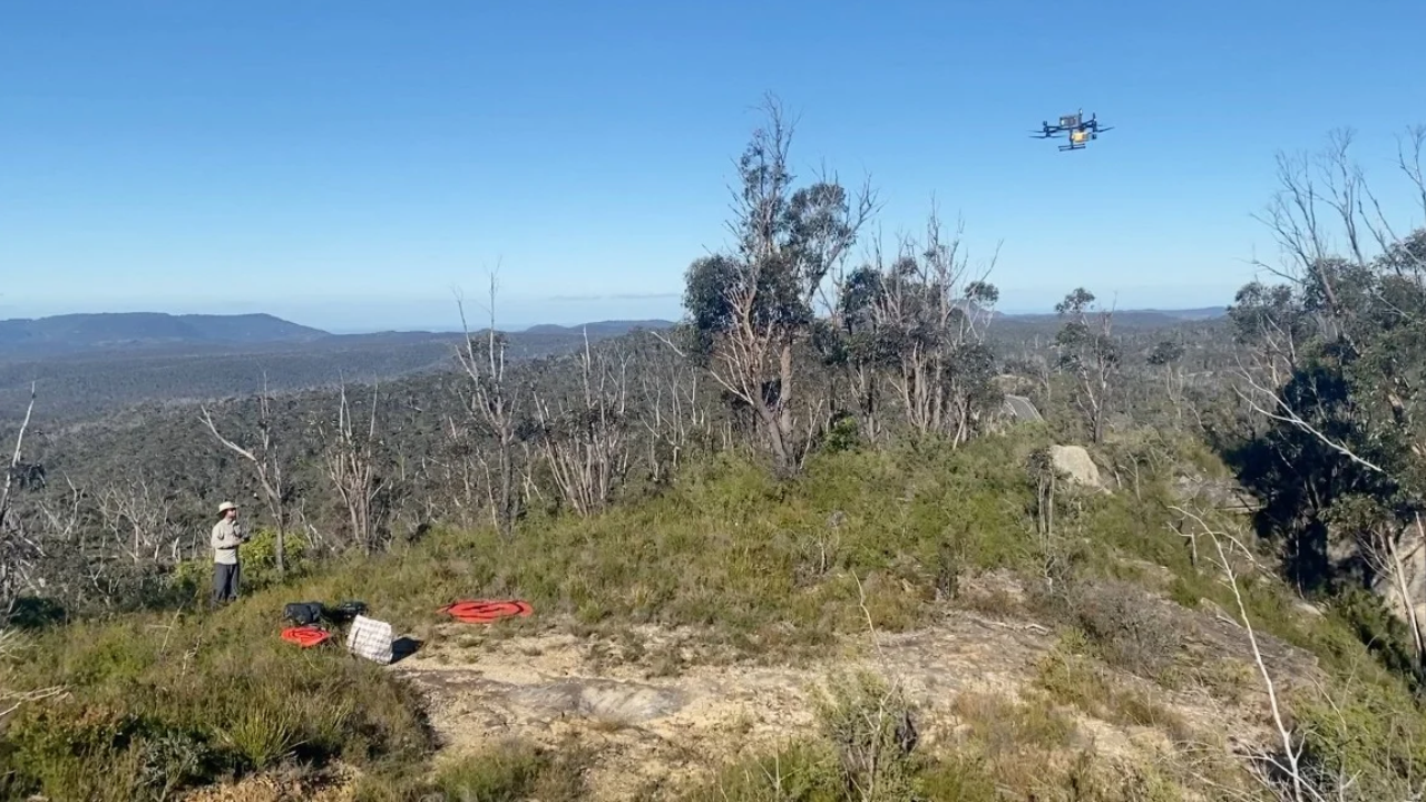
Light Detection and Ranging—LiDAR—measures distance by firing rapid laser pulses and timing the return. When mounted on an uncrewed aerial vehicle (UAV), a scanner can penetrate gaps in eucalypt foliage and map bare rock faces, ledges, and depressions at sub-decimeter resolution. In rugged terrain like the Blue Mountains west of Sydney, where sheer sandstone cliffs drop into deep slot canyons and scrub tears up field gear, aerial mapping saves legs.
That part is real. Nobody who has spent a week hauling survey equipment up a scree slope in forty-degree heat doubts the value of seeing the topography first.
Where the hype goes off the rails is confusing topographic visibility with archaeological discovery. A rock shelter is a concave recess under an overhang or cliff. A LiDAR point cloud can show a hollow in a cliff wall. It cannot tell you if that hollow has a flat floor suitable for occupation, whether water drips through the ceiling all winter, whether wallabies already claimed it, or whether it holds occupation deposits, grinding grooves, or stencil art.
Even more basic: "unregistered" does not mean "unknown to Indigenous people." In Australian heritage management, "unregistered" usually means the site has not yet been entered into a state or territory database, such as New South Wales's Aboriginal Heritage Information Management System (AHIMS). Treating a database gap as an empty map is a rookie mistake. Gundungurra, Darug, Wiradjuri, and other Traditional Owners have lived with and moved through these country systems for tens of thousands of years. A laser does not discover country. It merely catches up to a corner of it.
I have watched survey teams blow six-figure budgets chasing bright anomalies on hillshade models only to find natural talus hollows with zero cultural material. Meanwhile, the richest sites sometimes sit in plain sight along ridge lines or creek junctions where nobody bothered to fly a tight grid because the terrain looked "too obvious."
Imagine a scenario where a heritage consultancy flies a high-density drone LiDAR grid over three square kilometers of Blue Mountains gorge, flags twenty "promising" rock overhangs on a screen, and writes a glowing report about hidden sites—only to find that eighteen are sheer erosion notches and the two real shelters were already known informally to local knowledge holders. Which part of that workflow actually protected cultural heritage?
The Real Bottleneck Is Not Detection. It Is Triage and Consent.
If you ask most outsiders, "How do we find more unregistered Aboriginal rock shelters in rugged places like the Blue Mountains?" you are already asking a narrow, tech-obsessed question. A better question is: once you suspect a shelter exists in brutal terrain, how do you verify it without trashing fragile surfaces, and how do you make sure the data serves Indigenous governance rather than academic clout or developer checklists?
Let's look at the questions people actually type into search bars when headlines like this hit.
"Can drone LiDAR find ancient rock shelters that archaeologists missed?"
Sometimes it helps you spot candidates faster under tree cover. No, it does not "find" ancient shelters by itself. A shelter is defined by human use and cultural meaning, not geometry alone. Without ground-truthing, remote sensing only flags geomorphology. Over-promising automated discovery sets unrealistic expectations for funding bodies and the public, who start thinking a drone flight equals an excavation.
"Why are rock shelters in the Blue Mountains still unregistered?"
Scale, ruggedness, staffing, and history. The Greater Blue Mountains covers roughly a million hectares of steep cliffs, plateaus, and valleys. State heritage registers were built over decades with finite budgets, shifting priorities, and historical exclusion of Indigenous voices. Registering a site properly takes time, consultation, documentation, and care. It is not a race to slap pins on a map so a consulting firm can pad its portfolio.
"Is LiDAR better than traditional foot surveys?"
Neither replaces the other, though foot surveys still carry the heavier burden of truth. LiDAR excels at broad terrain modeling, spotting access routes, and mapping cliff lines before boots hit the dirt. Foot surveys—done properly with Traditional Owners and qualified archaeologists—are where you actually see floor deposits, smoke blackening, stone artifacts, and subtle surface cues a laser misses. Treat LiDAR as a reconnaissance scout, not the whole army.
Heavy Hitters, Hard Truths, and Where My View Breaks Down
Serious practitioners in Australian archaeology and remote sensing have been making adjacent points for years. Researchers working with airborne and UAV LiDAR across rugged landscapes—from figures like Damian Evans in archaeological remote sensing to Australian landscape archaeologists studying sandstone shelters and rock art such as Paul Taçon and Jo McDonald—have repeatedly shown that technology shines brightest when paired with deep regional context and strict ethical protocols.
When remote sensing gets treated as a shortcut around consultation, things go sideways fast. Data sovereignty matters. Publishing exact coordinates of sensitive rock shelters in a headline or open dataset can invite looting, chalking, climbing, or heavy foot traffic from thrill-seekers chasing viral spots. Rugged terrain slows some people down, sure. It does not stop everyone.
Here is where I have to admit the flip side of my own skepticism. Pushing hard against LiDAR hype can sound like dismissing useful tools. It is not. In steep Blue Mountains country where a wrong step can mean a helicopter rescue, sending crews blindly into every gully is reckless and slow. LiDAR can narrow down where to look, cut down wasted effort, and help document cliff morphology before rockfall or bushfire alters a slope.
Also, if you only preach slow, boots-on-the-ground work without acknowledging budget constraints, you sound detached from reality. State agencies, land managers, and Traditional Owner organizations deal with tight money and huge territories. A tool that stretches limited field hours is genuinely useful—provided nobody mistakes a 3D mesh for finished archaeological science.
| Approach | What It Does Well | Where It Falls Short | Best Practical Role |
|---|---|---|---|
| Drone LiDAR | Maps terrain under canopy, reveals cliff ledges & access routes safely | Cannot confirm cultural use, age, or sensitivity; creates false positives | Pre-field reconnaissance & terrain modeling |
| Foot Survey | Detects artifacts, deposits, micro-features, and real site condition | Slow, physically demanding, risky in steep gorges, limited coverage | Ground-truthing & detailed recording |
| Traditional Owner Knowledge | Holds deep spatial memory, cultural context, and governance authority | Can be bypassed or tokenized if outsiders rush to publish data | Core leadership, consent & site stewardship |
How to Actually Use Drone LiDAR Without Fooling Yourself
If you run heritage surveys, fund conservation, or cover archaeology beats, stop treating every LiDAR headline like a sci-fi breakthrough. Tighten up how you use the tech.
- Separate "anomalies" from "sites" in every report. Force teams to label UAV detections as topographic candidates until physically inspected. Never call an unvisited overhang a confirmed archaeological site in public copy.
- Lock down coordinate sensitivity before publishing. Keep exact locations out of promotional stories and public maps unless Traditional Owners explicitly approve public sharing and management controls exist.
- Budget for ground-truthing and consultation upfront. If you spend 80% of the budget flying drones and collecting point clouds, and 20% on field verification and proper engagement with Traditional Owners, your priorities are backward.
- Use LiDAR to protect country, not just chase scoops. Deploy high-res elevation models to monitor erosion, bushfire impacts, or track encroachment near known sensitive zones where boots would cause damage.
A laser can carve a million points out of sandstone shadows in an afternoon. Respecting the country those shadows belong to takes a hell of a lot longer.