Effective disaster response in transboundary river basins requires immediate bilateral coordination, real-time hydrological data sharing, and synchronized rescue logistics. When a sudden flash flood surges across international borders, the velocity of the water systematically outpaces standard bureaucratic response mechanisms. This analysis deconstructs the structural mechanics of the Bhote Koshi River flood in Nepal, examining the operational parameters of bilateral intervention, infrastructure vulnerability, and regional emergency management.
The Hydrological Trigger and Border Geometry
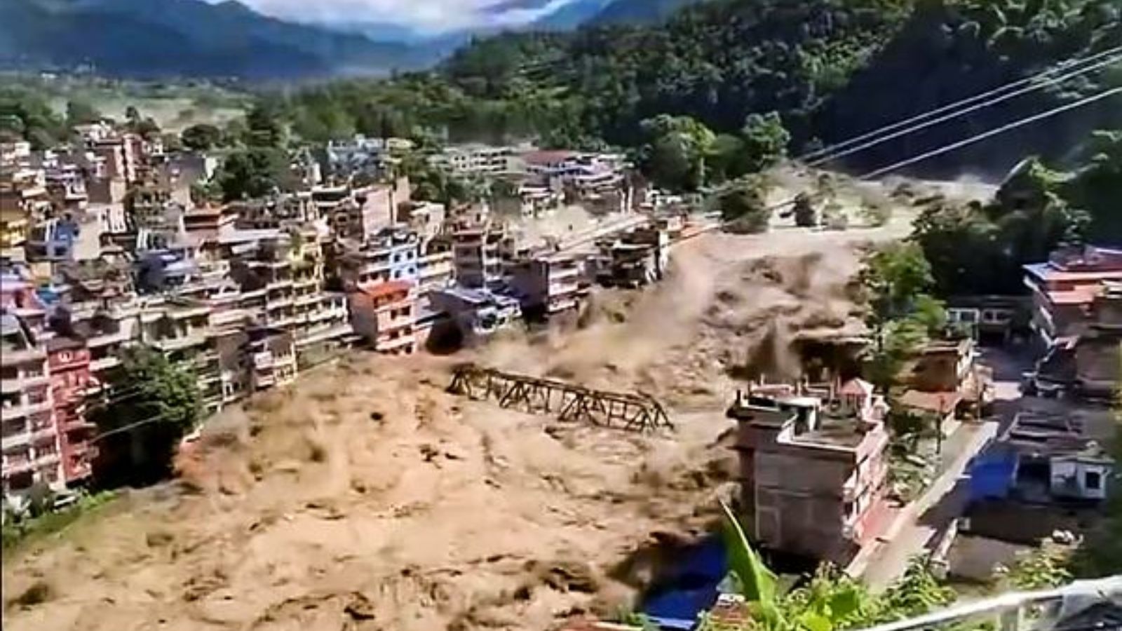
The flash flood originated north of the international boundary in Tibet, surging down the Bhote Koshi River corridor into Nepal's Rasuwa district at approximately 09:00 local time. Transboundary river systems present a distinct operational hazard because early warning indicators are geographically decoupled from downstream populations at risk. For an alternative look, consider: this related article.
The physical mechanism involved a sudden volume displacement, compounded by mudslides and debris loading near the border zone. As water volume escalated, the narrow mountain gorges acted as hydraulic funnels, maximizing kinetic energy and destroying baseline infrastructure, including a dozen micro-hydropower installations and transit bridges along the Rasuwagadhi-Timure axis.
The primary variables governing the impact zone include: Similar reporting regarding this has been shared by The New York Times.
- Time-to-Inundation Index: The interval between upstream displacement and downstream impact, which in narrow Himalayan valleys is frequently under one hour.
- Debris Flow Coefficient: The ratio of solid sediment to liquid volume, which dictates the destructive capacity against concrete foundations and bridge piers.
- Asset Concentration Density: The high density of transient populations, including pilgrims and commercial transit operators, clustered along narrow valley roads.
Bilateral Intervention and Diplomatic Mechanics
Following the breach, Indian Prime Minister Narendra Modi contacted Nepalese Prime Minister Balendra Shah to coordinate humanitarian assistance and disaster relief operations. From a strategic standpoint, cross-border crisis management depends on three institutional layers: diplomatic signaling, logistical integration, and intelligence sharing.
Bilateral communication protocols establish the legal and political clearance required for external search-and-rescue assets to operate within sovereign territory. In this instance, the diplomatic framework enabled operational alignment between the Nepal Army, Armed Police Force, and specialized external relief units.
The friction points in such interventions typically manifest in communication delays and asset deployment latency. When hundreds of individuals—including over one hundred Indian nationals traveling toward the Kailash Mansarovar Yatra—are reported missing or out of contact in rugged terrain, reconnaissance efficiency becomes the primary metric of success. Aerial assets, including helicopters equipped with thermal imaging and specialized drone squads, must be deployed within an operational window before hypothermia or secondary landslides compound initial casualties.
Infrastructure Vulnerability and Regional Economic Fallout
The destruction of multiple hydropower facilities and arterial transport links highlights the fragility of high-altitude economic infrastructure in the Himalayas. Energy assets built directly into riverbeds or narrow banks face severe structural liabilities during high-velocity debris flows.
The economic cost function incorporates direct asset write-downs, grid instability resulting from lost generation capacity, and the severance of commercial trade corridors between South Asia and the Tibetan plateau. Downstream districts, including Nuwakot, Dhading, and Chitwan, faced immediate secondary threats as the flood pulse propagated through the Trishuli river system. Emergency administrators executed localized evacuations by issuing downstream warning pulses, demonstrating that early warning dissemination velocity remains the single most effective countermeasure to rising water levels.
Resource Allocation Matrix for Immediate Stabilization
Managing large-scale missing persons events in mountainous terrain requires strict prioritization of scarce rescue capabilities. The operational response is constrained by geographical isolation and compromised road networks.
- Phase One: Air-mobile reconnaissance and deployment of search teams equipped with canine units to high-probability stranding zones along river banks.
- Phase Two: Establishment of consolidated communication nodes to process family tracing requests and manage institutional coordination between the Indian Embassy in Kathmandu and local district administration offices.
- Phase Three: Engineering assessment of damaged bridges and stabilization of riverbanks to prevent secondary flash floods caused by temporary landslide dams.
Establish automated, sensor-driven hydrological telemetry loops across the Tibet-Nepal border to transmit real-time discharge data directly to downstream emergency operation centers, bypassing diplomatic latency during critical weather events.